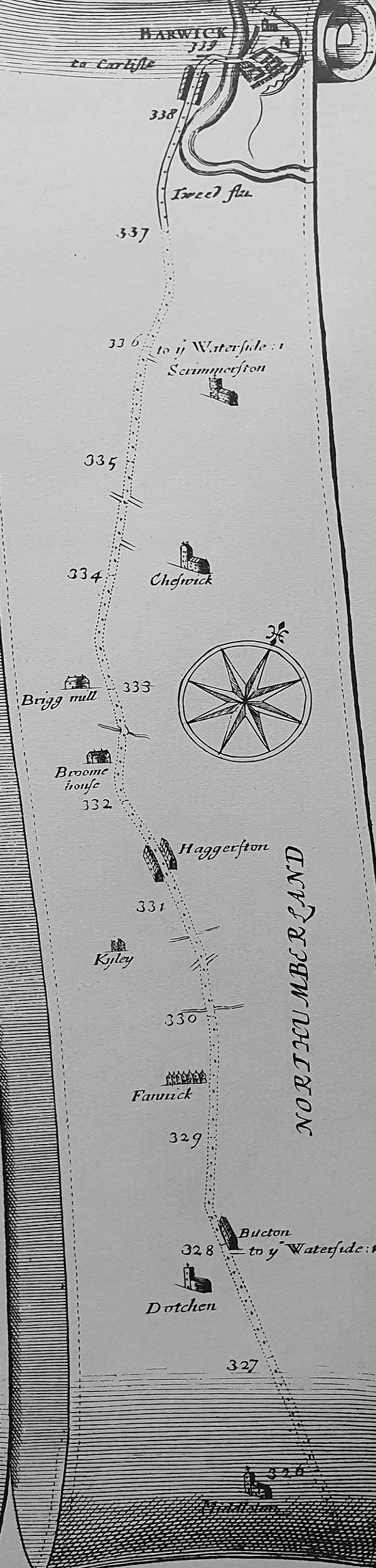
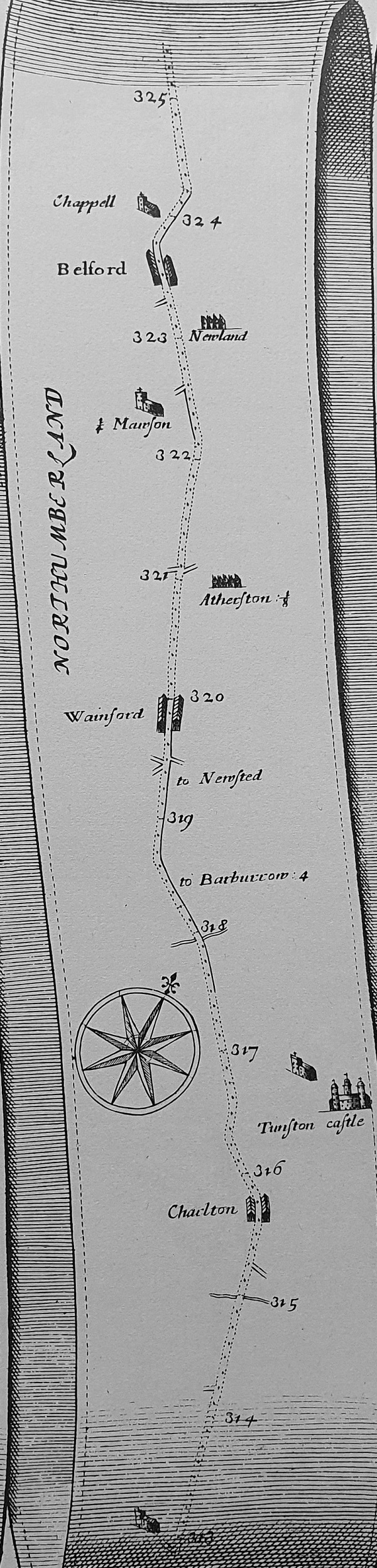
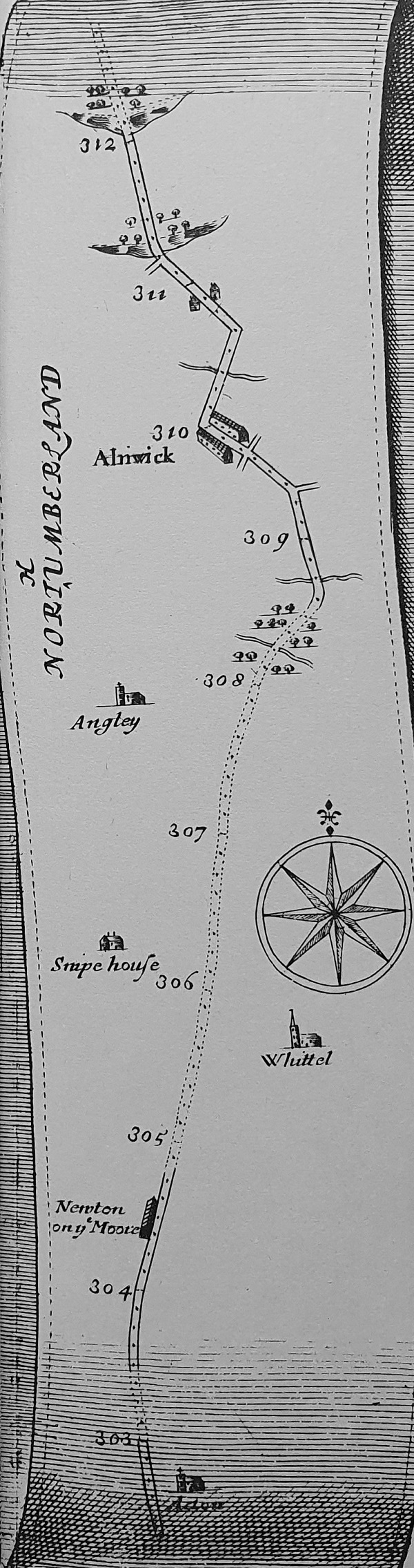
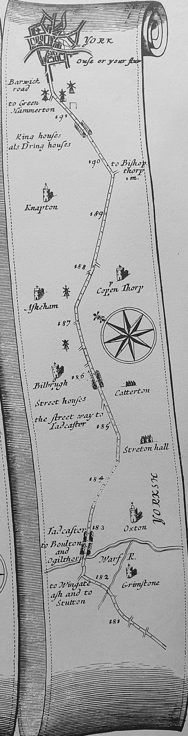
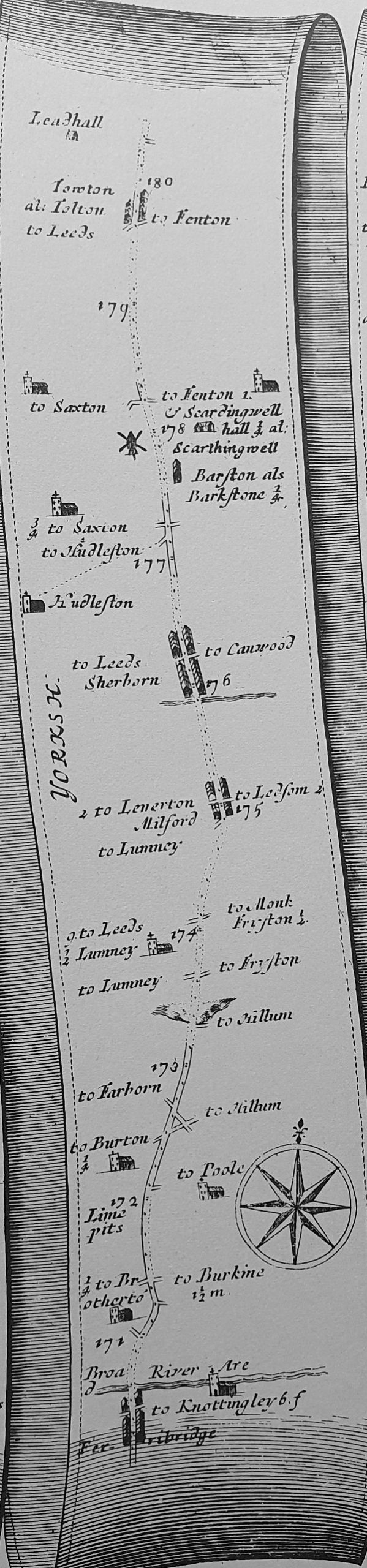
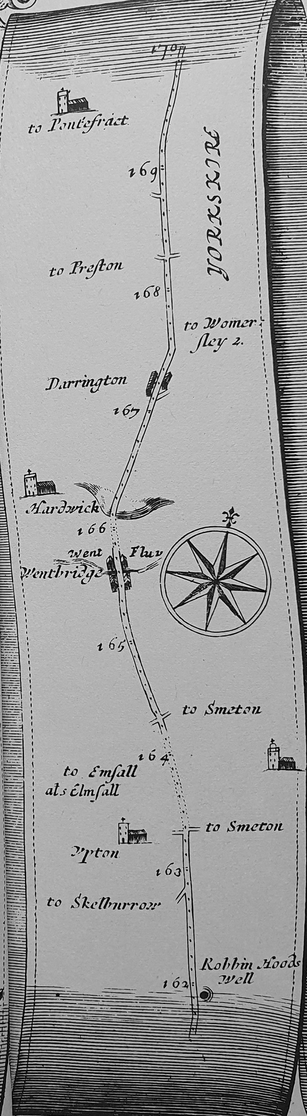
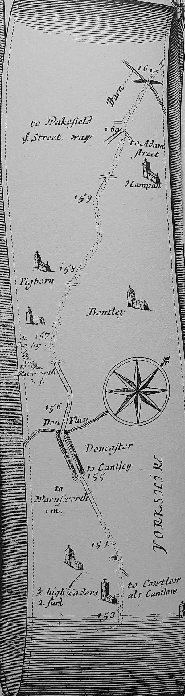
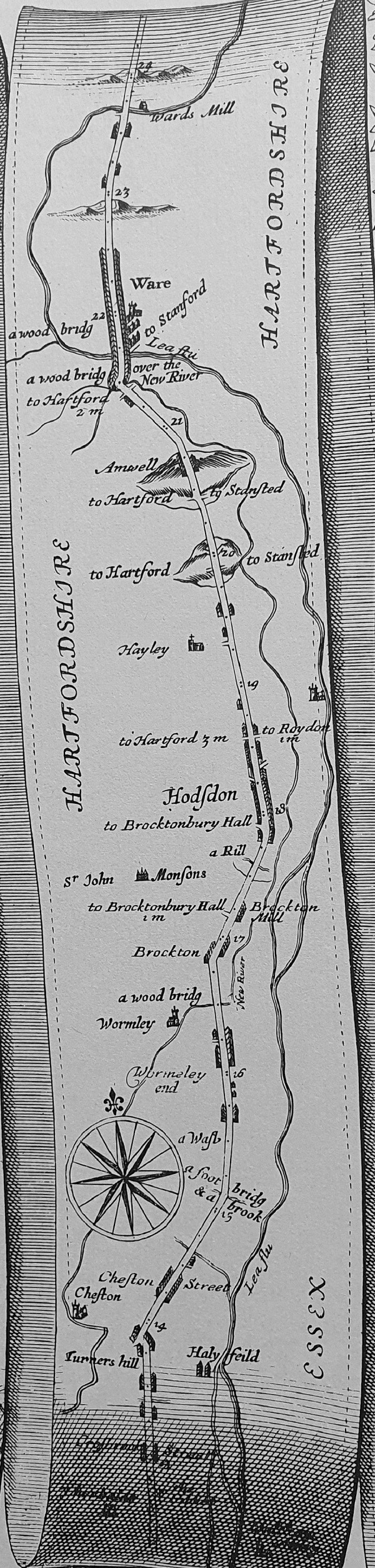
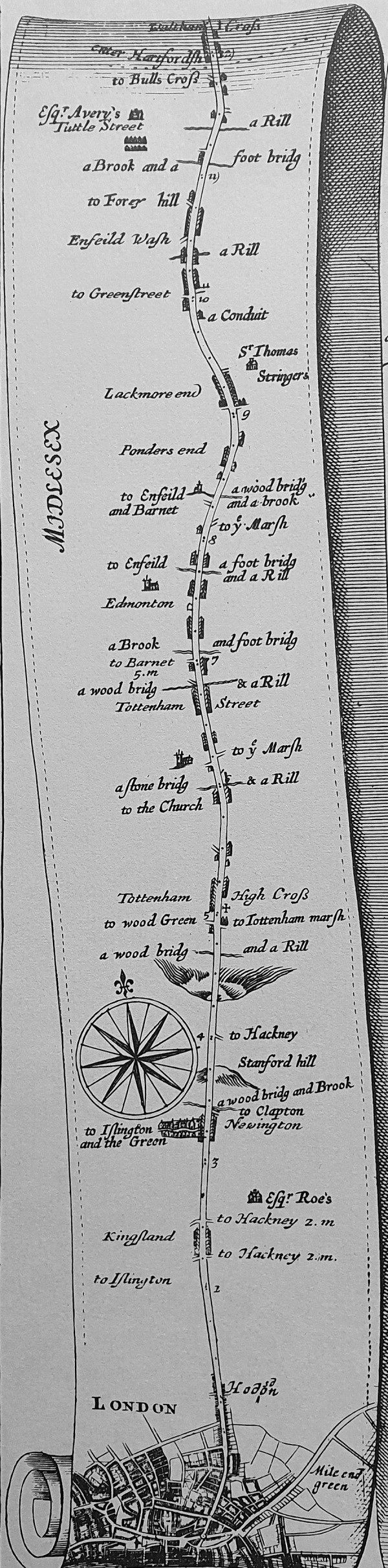
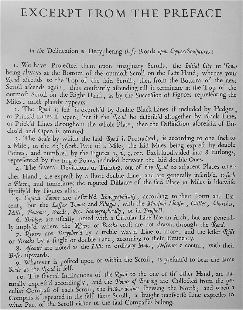
Ogilby’s 1675 Maps of the Great North Road
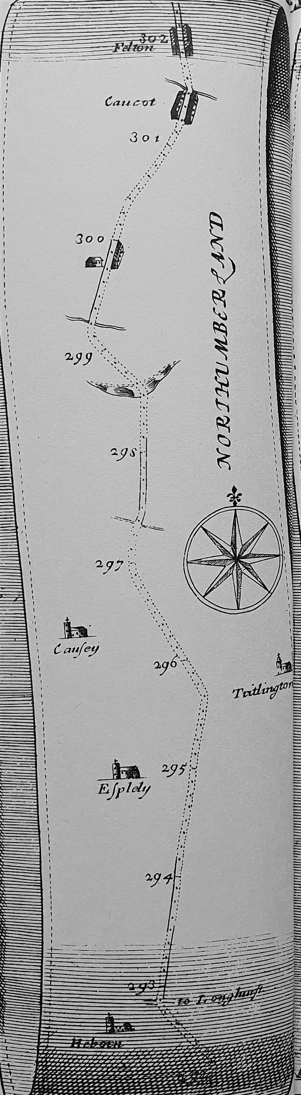
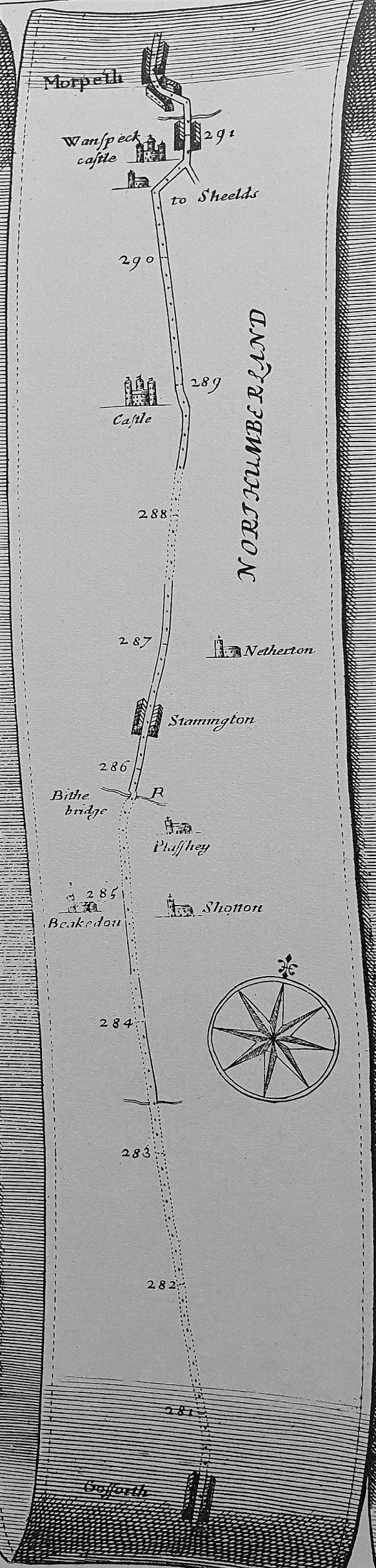
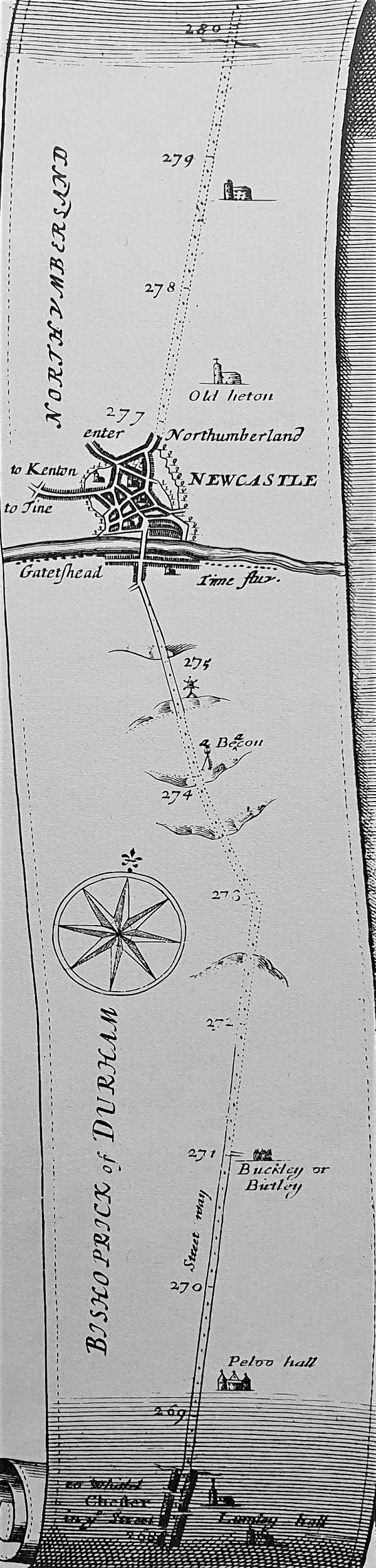
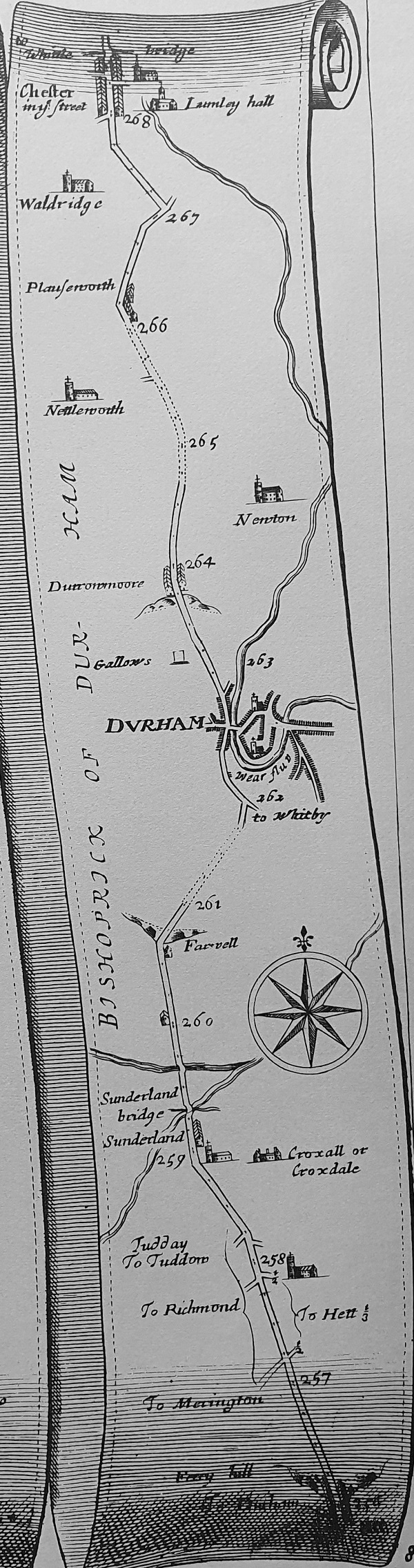
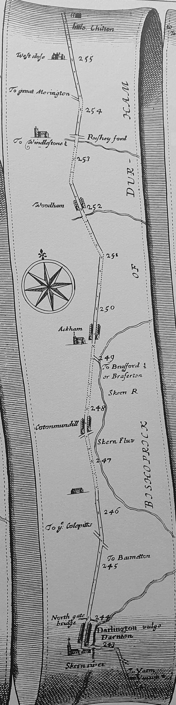
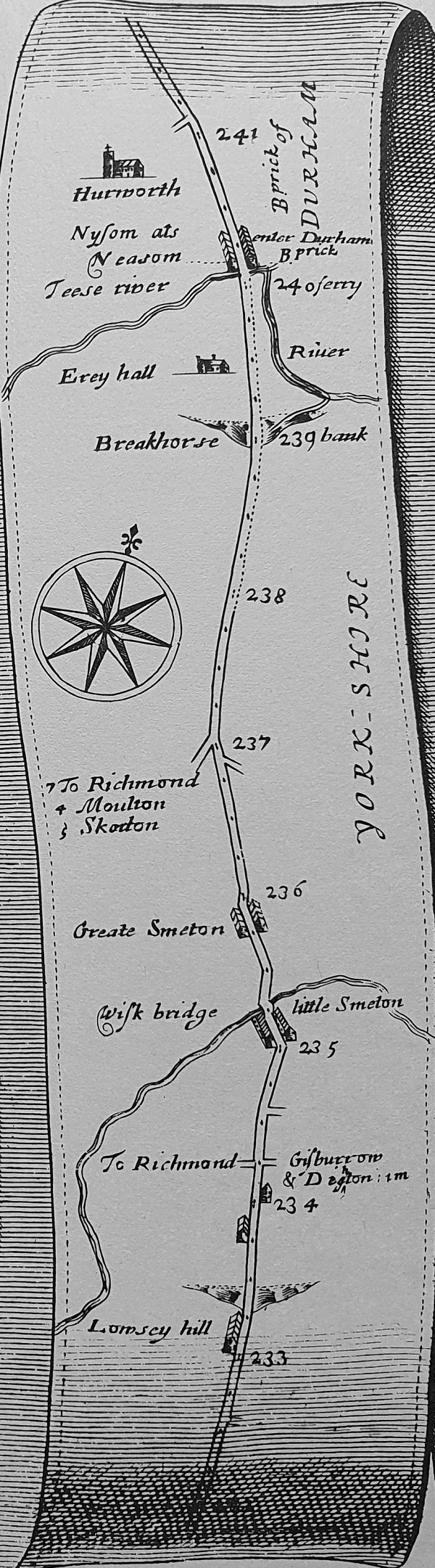
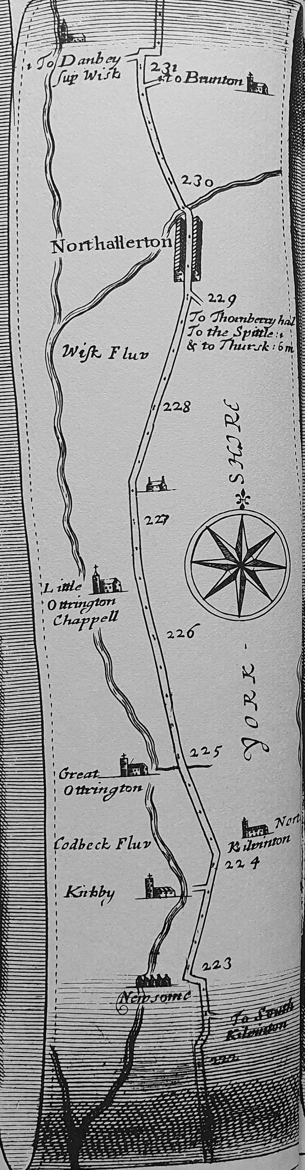
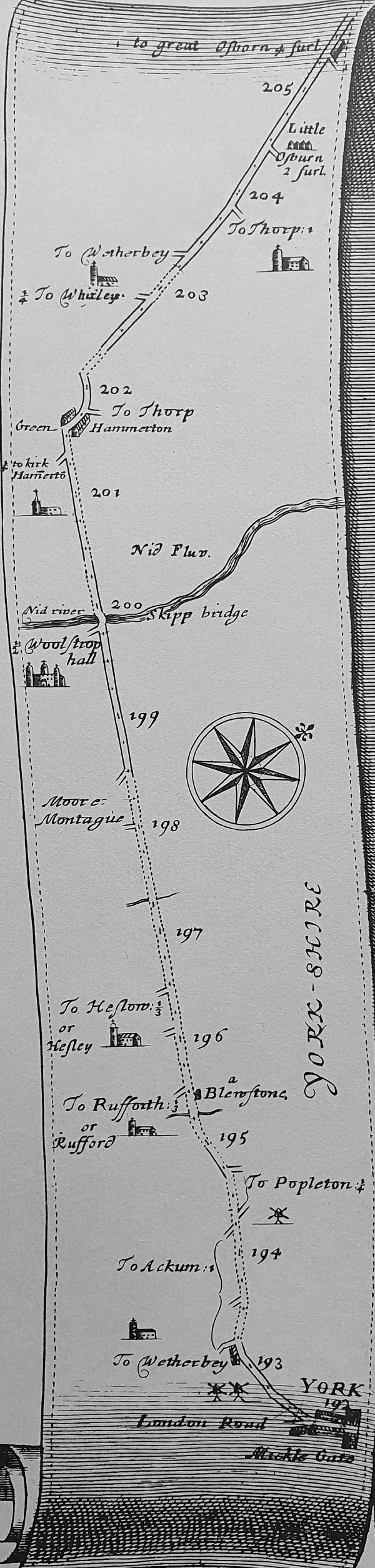
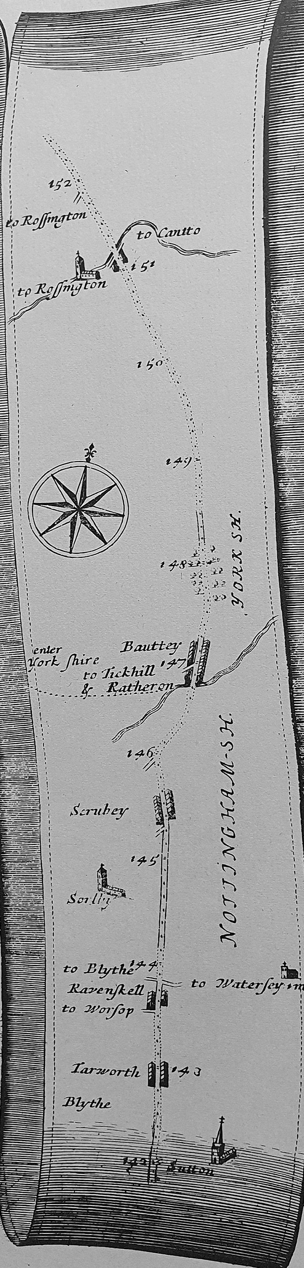
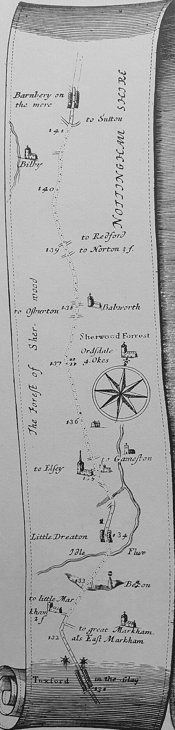
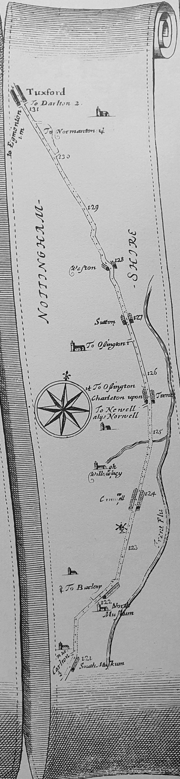
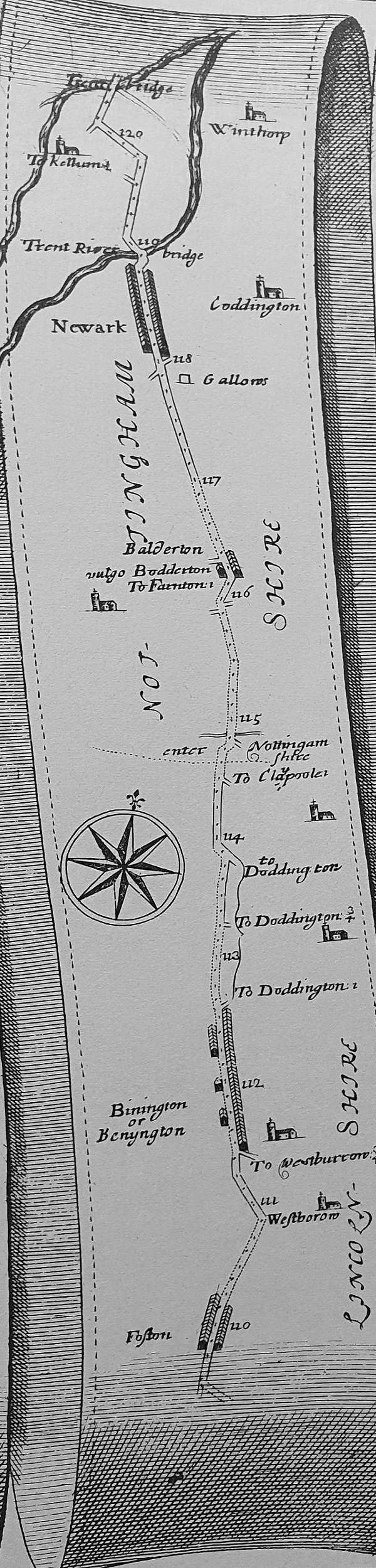
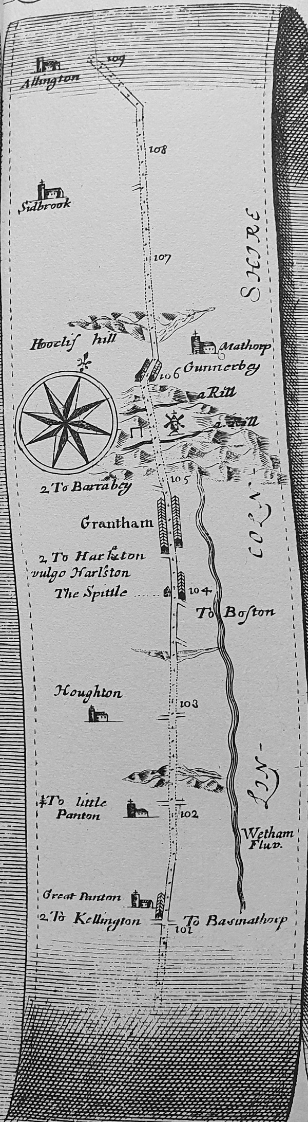
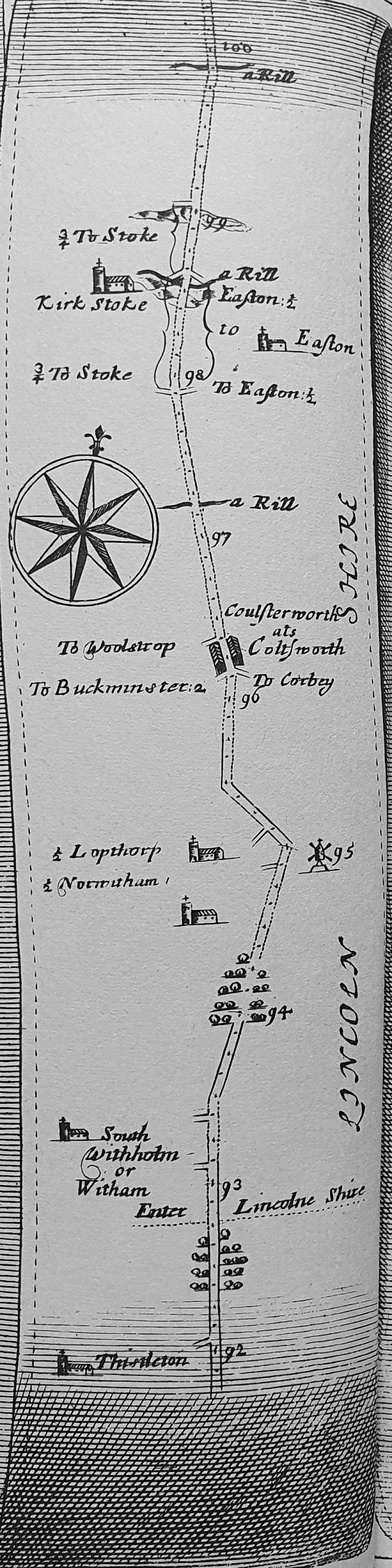
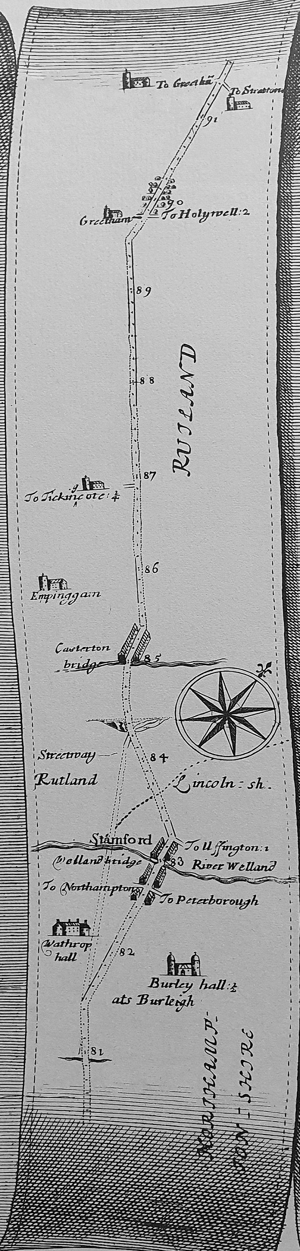
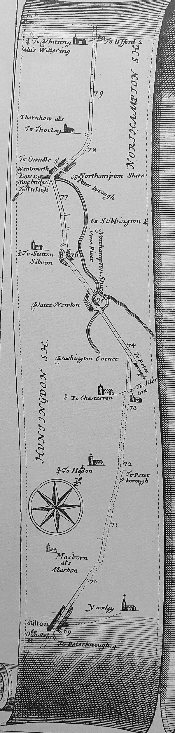
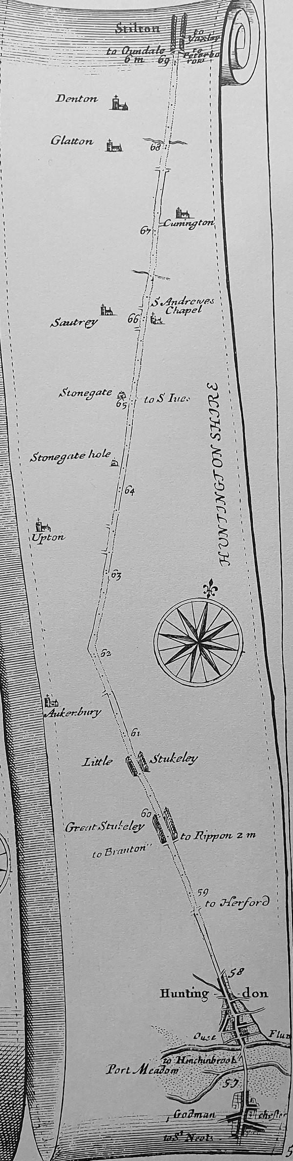
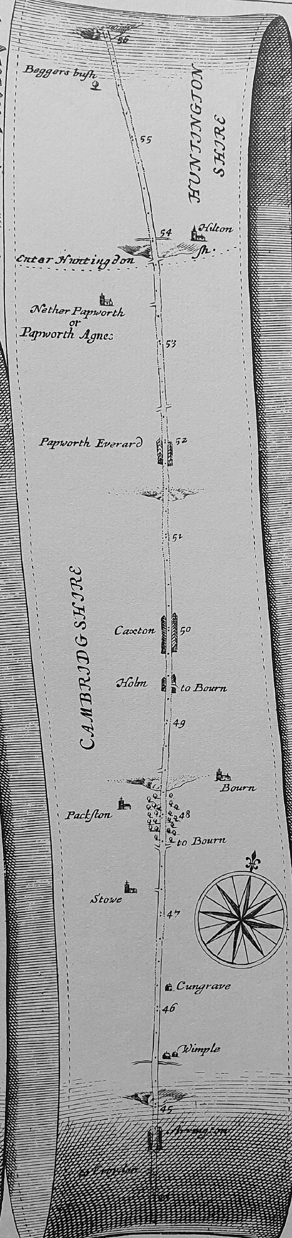
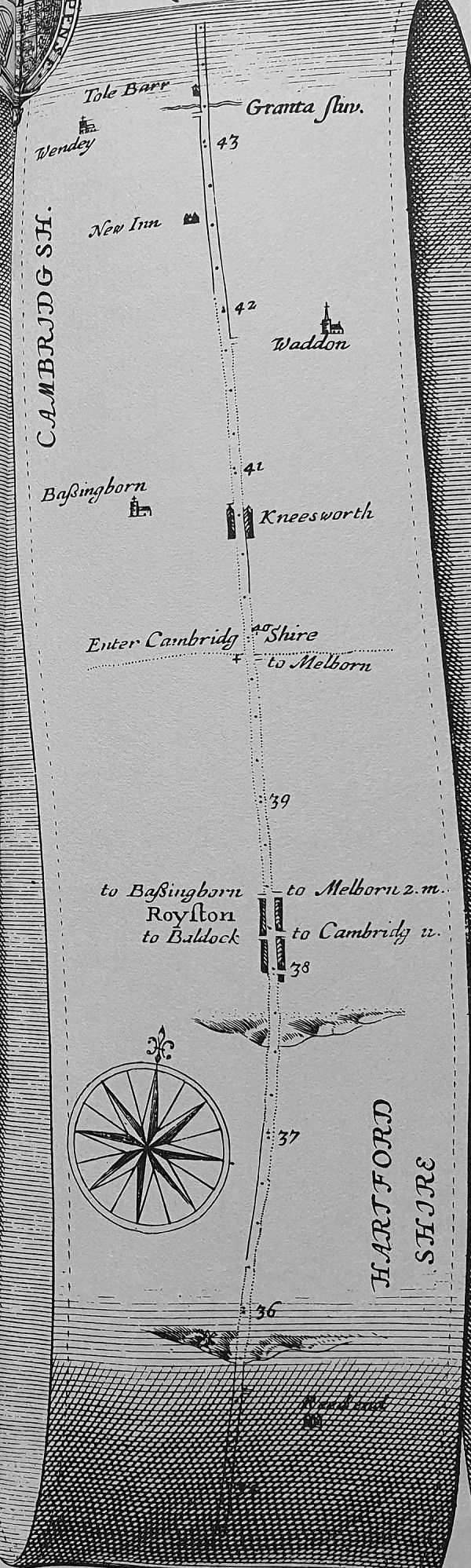
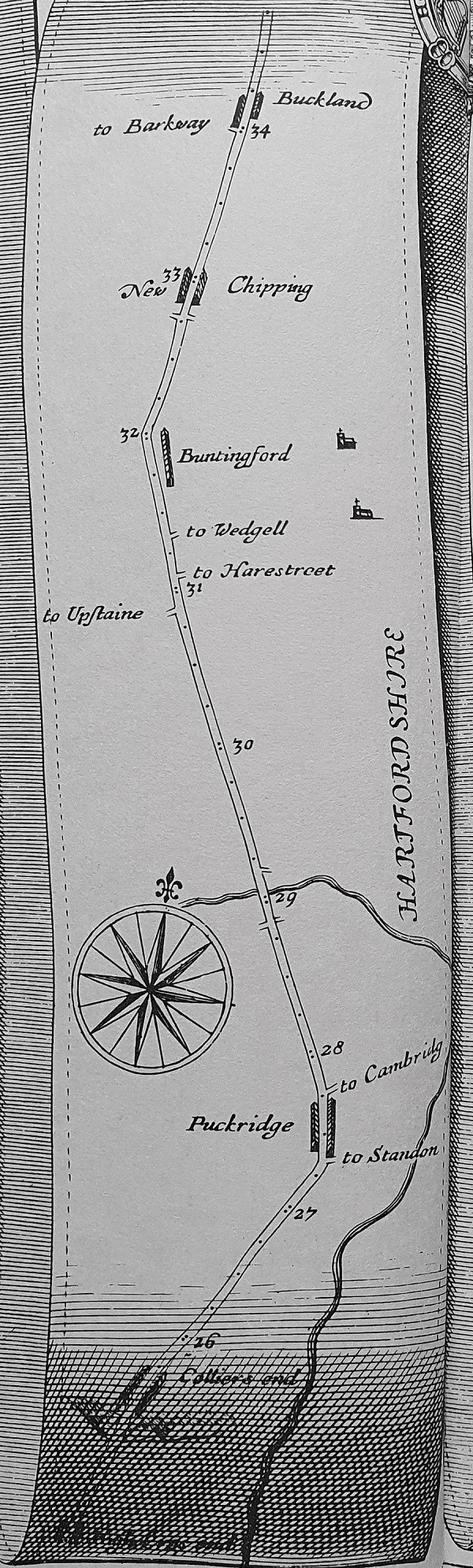
John Ogilby’s Britannia was an early road atlas of England and Wales. Each of his chosen roads was displayed in linear form. The route from London to “Barwick” comprised 5 plates, each with 6 sections.
The 339 miles are all numbered – and furlongs indicated by dots! Note that a solid line for the road edge indicates enclosed rather than open land.
![Ogilby 30](https://greatnorthroad.co.uk/wp-content/uploads/2020/11/20201117_144620-crop30d.jpg)
![Ogilby 29](https://greatnorthroad.co.uk/wp-content/uploads/2020/11/20201117_144617-crop29.jpg)
![Ogilby 28](https://greatnorthroad.co.uk/wp-content/uploads/2020/11/20201117_144613-crop28.jpg)
![Ogilby 27](https://greatnorthroad.co.uk/wp-content/uploads/2020/11/20201117_144613-crop27.jpg)
![Ogilby 26](https://greatnorthroad.co.uk/wp-content/uploads/2020/11/20201117_144609-crop26b.jpg)
![Ogilby 25](https://greatnorthroad.co.uk/wp-content/uploads/2020/11/20201117_144605-crop25b.jpg)
![Ogilby 24](https://greatnorthroad.co.uk/wp-content/uploads/2020/11/20201117_144550-crop24.jpg)
![Ogilby 23](https://greatnorthroad.co.uk/wp-content/uploads/2020/11/20201117_144546-crop23.jpg)
![Ogilby 22](https://greatnorthroad.co.uk/wp-content/uploads/2020/11/20201117_144543-crop22.jpg)
![Ogilby 21](https://greatnorthroad.co.uk/wp-content/uploads/2020/11/20201117_144543-crop21.jpg)
![20201117_144539-crop20c Ogilby 20](https://greatnorthroad.co.uk/wp-content/uploads/2020/11/20201117_144539-crop20c.jpg)
![Ogilby 19](https://greatnorthroad.co.uk/wp-content/uploads/2020/11/20201117_144536-crop19.jpg)
![Ogilby 18](https://greatnorthroad.co.uk/wp-content/uploads/2020/11/20201117_144520-crop18.jpg)
![Ogilby 17](https://greatnorthroad.co.uk/wp-content/uploads/2020/11/20201117_144517-crop17-scaled.jpg)
![Ogilby 16](https://greatnorthroad.co.uk/wp-content/uploads/2020/11/20201117_144512-crop16.jpg)
![Ogilby 15](https://greatnorthroad.co.uk/wp-content/uploads/2020/11/20201117_144512-crop15.jpg)
![Ogilby 14](https://greatnorthroad.co.uk/wp-content/uploads/2020/11/20201117_144507-crop14b.jpg)
![Ogilby 13](https://greatnorthroad.co.uk/wp-content/uploads/2020/11/20201117_144503-crop13b.jpg)
![Ogilby 12](https://greatnorthroad.co.uk/wp-content/uploads/2020/11/20201117_144440-crop12-scaled.jpg)
![Ogilby 11](https://greatnorthroad.co.uk/wp-content/uploads/2020/11/20201117_144436-crop11b.jpg)
![Ogilby 10](https://greatnorthroad.co.uk/wp-content/uploads/2020/11/20201117_144430-crop10.jpg)
![Ogilby 9](https://greatnorthroad.co.uk/wp-content/uploads/2020/11/20201117_144430-crop9.jpg)
![Ogilby 8](https://greatnorthroad.co.uk/wp-content/uploads/2020/11/20201117_144425-crop8b.jpg)
![Ogilby 7](https://greatnorthroad.co.uk/wp-content/uploads/2020/11/20201117_144421-crop7.jpg)
![Ogilby 6](https://greatnorthroad.co.uk/wp-content/uploads/2020/11/20201117_144404-crop6b.jpg)
![Ogilby 5](https://greatnorthroad.co.uk/wp-content/uploads/2020/11/20201117_144356-crop5b.jpg)
![Ogilby 4](https://greatnorthroad.co.uk/wp-content/uploads/2020/11/20201117_144348-crop4b.jpg)
![Ogilby 3](https://greatnorthroad.co.uk/wp-content/uploads/2020/11/20201117_144348-crop3b.jpg)
![Ogilby2](https://greatnorthroad.co.uk/wp-content/uploads/2020/11/20201117_144332-crop2b.jpg)
![Ogilby 1](https://greatnorthroad.co.uk/wp-content/uploads/2020/11/20201117_144322-crop1b.jpg)
![Ogilby Legend](https://greatnorthroad.co.uk/wp-content/uploads/2020/11/20201117_154440-key-lr.jpg)
Distances
Ogilby’s Britannia measured distances from “The Standard” in Cornhill, London. This was a water cistern with four spouts made by Peter Morris, a German, in 1582. It was the first mechanically pumped public water supply in London and stood at the junction of Gracechurch Street, Bishopsgate Street, and Leadenhall Street. The water ceased to run at the end of the 16th century but the Standard remained until 1674. As well as being the datum for Ogilby, many of the milestones erected along the new turnpikes were referenced to this point.
![ogilby-cornhill-standard-lionel-joseph Cornhill Standard - Lionel Joseph](https://greatnorthroad.co.uk/wp-content/uploads/2020/11/ogilby-cornhill-standard-lionel-joseph-400x535.jpg)
The Cornhill Standard as shown on a parish map of 1599 held by the City of London Guildhall Library